
Applied AI for infrastructure, sensing, and scientific prediction
We build computer-vision, deep-learning, and forecasting systems that turn complex, real-world data into reliable decisions from infrastructure monitoring to biomedical and environmental analysis.
About
What we do ...
ATLAS AI is a United States based research and development company that designs and deploys artificial intelligence systems for demanding, data-rich problems. Our work spans computer vision, time-series forecasting, signal processing, and multimodal data fusion, built not as demonstrations, but as deployable pipelines validated through rigorous testing.
We focus on problems where accuracy and reliability matter: assessing infrastructure, interpreting sensor and imaging data, and predicting the behavior of complex physical and biological systems.
What we work on ...
Infrastructure monitoring and predictive maintenance
AI systems that detect damage, assess severity, and recommend maintenance actions for roadways, power transmission lines, and utility networks. Combining computer vision, geospatial analytics, and cost-aware decision support to help agencies prioritize work and reduce inspection costs.
Computer vision and remote sensing
Detection, classification, and condition assessment from imagery. Including aerial and drone-based inspection using RGB, thermal, and geospatial data.
Forecasting and scientific modeling
Physics-informed and data-driven models for spatiotemporal prediction, including environmental and oceanographic systems, field reconstruction from sparse data, and rigorous backtesting.
Biomedical and signal-processing AI
Deep-learning models for medical imaging, disease detection, biometrics, and bioacoustics. Applying transfer learning and careful validation to perform well with limited labeled data.
How we work ...
Our approach is grounded in research discipline and engineering practice. We build scalable AI pipelines for high dimensional, noisy, heterogeneous data; we validate models rigorously through systematic evaluation and backtesting; and we deliver reproducible, production oriented systems with proper documentation and post deployment monitoring. The goal is always the same: AI that holds up outside the lab.
Who we serve ...
We work with organizations that need trustworthy AI for high-stakes decisions: transportation and public-works agencies, utilities and infrastructure operators, research programs, and engineering teams that need applied AI translated into working tools.
Research & Credentials ...
Although, ATLAS AI has been established in 2025, but it is led by PhD-level researchers in electrical engineering, computer engineering, and computer science, who have more than a decade of experience translating advanced AI into deployable systems across computer vision, forecasting, biometrics, and bioacoustics. Our experience includes work supported by national research programs and federal agencies, spanning healthcare AI, environmental modeling, and sensing.
Contact
You can find us in ..

• Boca Raton, Florida, USA ... main office
• Torrento, Canada
• London, UK
• Sydney, Australia
• Baghdad, Iraq
• Riyadh, Saudi Arabia
• Dubai, UAE
• Beirut, Lebanon
• Istanbul, Turkey
• Islamabad, Pakistan
• Belgrade, Serbia
We welcome the opportunity to work with you. To get started, please complete the contact form on this page or write to us directly at [email protected]. Let us know about your business and objectives, and we will provide a customized quote for your project.
Projects & Research
Active Projects
Automated Pothole Detection & Road Treatment Optimization
Computer Vision · Geospatial Analytics · Pavement Lifecycle Intelligence
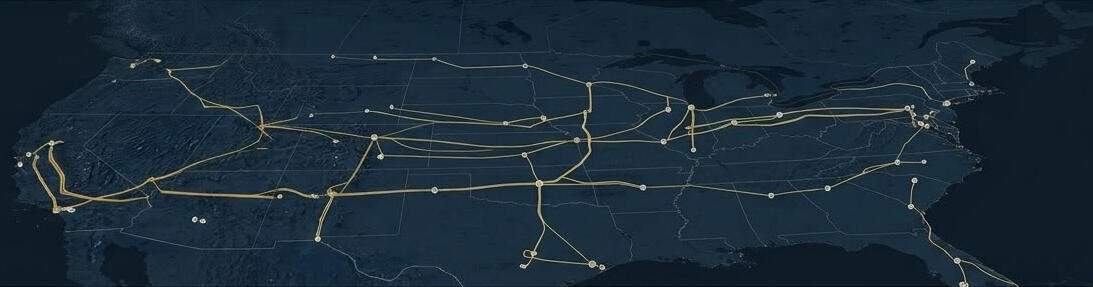
An AI-driven roadway damage assessment framework that automates the full pipeline from defect detection to treatment recommendation. Computer vision models analyze road inspection imagery to detect and classify pavement distress; potholes, cracking, rutting, and delamination, and estimate severity from morphological, traffic load, and environmental features. A decision support engine then recommends the optimal treatment strategy for each segment; crack sealing, patching, resurfacing, or reconstruction, by balancing pavement condition indices, structural risk, and cost efficiency. The output is a prioritized, geospatially mapped maintenance plan ready for municipal and transportation agency use.
Power Line Drone Inspection System
Autonomous UAV · Thermal & RGB Imaging · Real-Time Fault Detection
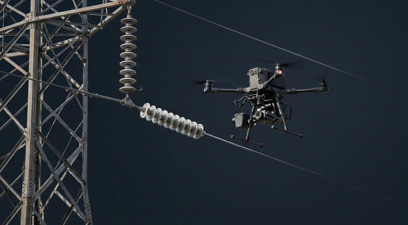
An autonomous drone-based inspection system for high-voltage power transmission lines that replaces costly and hazardous manual surveys with intelligent UAV flights. Deep learning models fuse thermal imaging, RGB video, and onboard geospatial telemetry to detect and classify Electrical instrument and components, damages, faults, vegetation encroachment, corrosion, and structural degradation in real time. Detected faults are geolocated, severity-scored, and routed through an automated reporting pipeline that delivers prioritized maintenance actions directly to utility asset management teams.
AI Infrastructure Monitoring & Predictive Maintenance
Computer Vision · Time-Series Forecasting · Operational Analytics
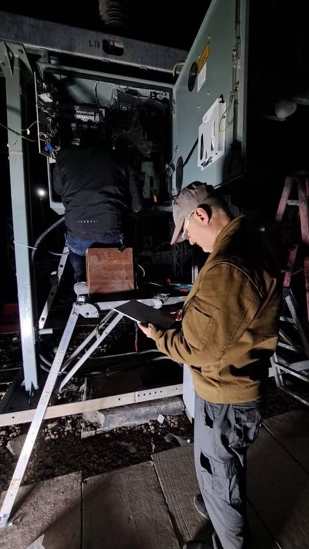
An end-to-end platform that continuously monitors distributed utility assets, detects early degradation using computer vision and time-series forecasting, and delivers prescriptive maintenance recommendations before failures occur. The system integrates risk scoring, operational constraints, and cost efficiency modeling to prioritize technician dispatch, maintenance scheduling, and asset rehabilitation across large scale networks. Production grade ML and generative AI workflows handle automated reporting, post deployment monitoring, and maintenance copilot functions; reducing manual workload while improving decision speed and consistency.
Research Portfolio
Peer reviewed and federally funded research underpinning the ATLAS AI technical strength, conducted by the company's principals and senior technical staff.
Ocean Current Modeling & Prediction
Dynamic Modeling · Spatiotemporal Forecasting · Sparse Data · Fluid Constraints
Funds: National Academies of Sciences, Gulf Research Program
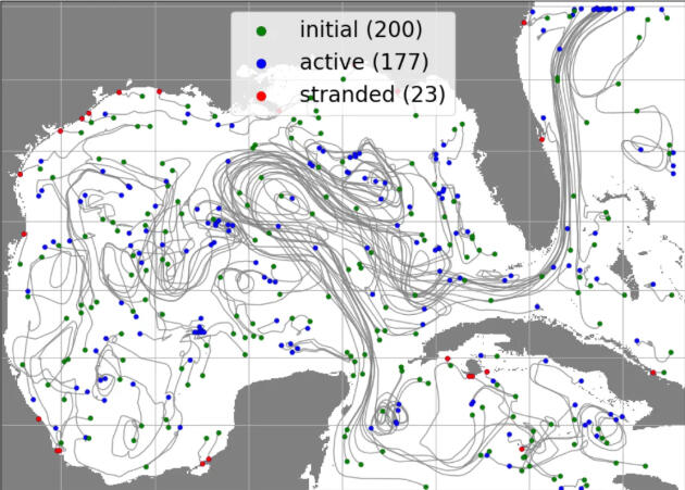
Ocean current prediction underpins hurricane intensity forecasting, oil spill response, and offshore operations, yet observations are sparse and numerical models drift from reality over time. This work addresses both problems. Learned bias correction models retain the spatial and temporal structure of model to observation differences, producing correction weights that extend up to a year beyond the observation period and improving accuracy over baseline numerical output by more than 85%. Separately, physics informed neural networks reconstruct full surface velocity fields from scattered drifter measurements at correlation above 0.91 across the Gulf of Mexico, recovering coherent structure from measurement density far below what conventional interpolation requires. The same reconstruction methods now support pavement condition estimation from incomplete field data.
Publications:
Bioacoustics Detection & Localization
Signal Processing · Acoustic Array Processing · Marine Species Monitoring
Funds: Defense Advanced Research Projects Agency (DARPA)
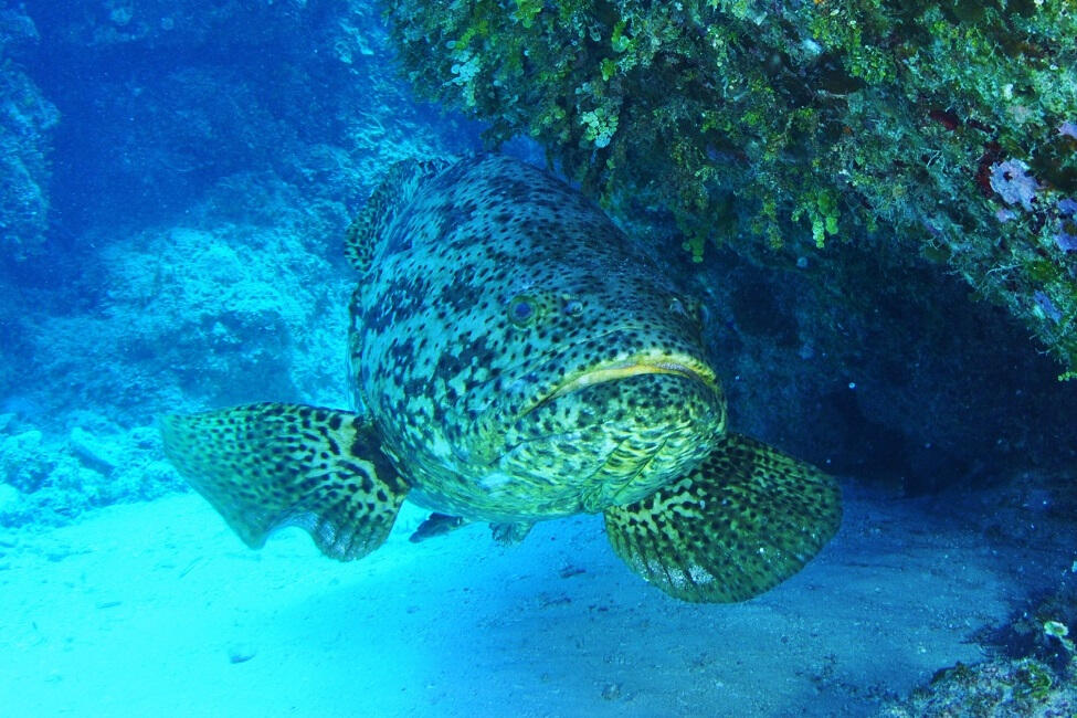
Marine species monitoring has historically depended on manual review of acoustic recordings, a process that cannot scale to the volumes modern hydrophone deployments produce. Deep learning classifiers can automate that pipeline end to end, and identify species from vocalizations, array processing localizes individual animals to within a few meters, and automated detection frameworks process tens of thousands of recordings in hours rather than months. The most recent detection framework processes 10020 second files in under two and a half hours at roughly 90% accuracy across four Caribbean grouper species. Complementary work uses animal borne multi sensor tags to classify behavior directly, and autonomous surface vehicles to extend survey coverage beyond fixed hydrophone positions. Applications span protected species monitoring, spawning aggregation assessment, and fisheries management.
Publications:
Neurological Signal AI
EEG · Seizure · Alzheimer · Sleep Disorders
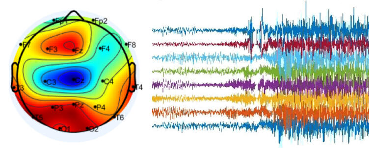
EEG carries clinically decisive information in a signal that is noisy, non stationary, and difficult to interpret at scale. Applying deep learning to three problems where earlier detection changes patient outcomes. Seizure prediction identifies preictal states before onset, giving patients warning time that reactive detection cannot provide. Alzheimer's and frontotemporal dementia classification extracts diagnostic features from EEG, offering a lower cost and more accessible path than imaging based diagnosis. Sleep disorder classification distinguishes among eight conditions automatically, reducing the manual scoring burden that limits sleep laboratory throughput.
Publications:
Genomics and Drug Discovery AI
Biomarkers · miRNA · DNA · Cascade Transfer Learning · Low Sample Count
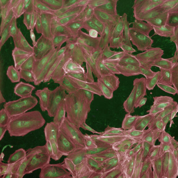
Genomic datasets present a structural problem for machine learning; thousands of features measured across relatively few patients, where most features carry no signal. Developing feature selection and classification approaches, and applied to breast cancer; the methods validate specific miRNAs as diagnostic biomarkers and go further by distinguishing among the four clinical stages of the disease, which matters because treatment decisions turn on stage rather than presence alone. Using neighborhood component analysis and minimum redundancy maximum relevance across more than a thousand tissue samples, the approach reaches accuracy of up to 0.983, against 0.920 for the conventional fold change method, with the largest gains in the earliest stages where detection is most valuable and hardest. Applied to kidney cancer, related methods distinguish among tumor subtypes that guide treatment selection. The same modeling philosophy extends to drug discovery, where cascade transfer learning ranks candidate compounds by predicted efficacy, compressing the early screening stage that conventionally consumes the most time in the discovery pipeline.
Publications:
Medical Imaging and Diagnostic AI
Generative AI · Transfer Learning · Medical Imaging · Disease Detection & Classification
Funds: U.S. National Science Foundation
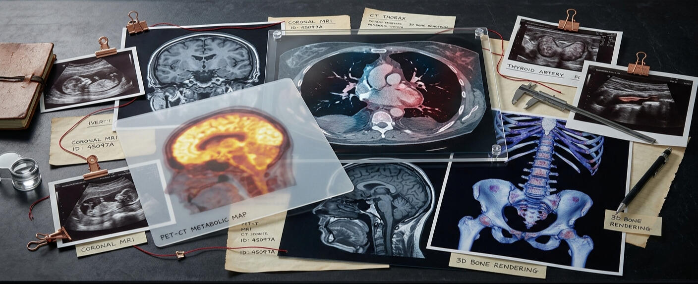
A broad program of applied deep learning research across high impact healthcare domains. Work includes: Alzheimer's disease detection from FDG-PET imaging using transfer learning; Diabetic Retinopathy severity classification from retinal fundus images; COVID-19 classification using a two-stage deep learning approach; Skin Cancer detection; and White Blood Cells classification. A consistent focus across all work is achieving strong performance under limited labeled data through transfer learning, cross-validation, and systematic model evaluation.
Publications:
Human Activity Recognition & Multimodal Fusion
Wearable Sensors · Multimodal Fusion

Designed multimodal deep learning architectures that jointly process wearable inertial sensor data and visual imagery for real-time human activity and health monitoring. Work spans feature engineering, cross-dataset generalization, and systematic fusion evaluation across multiple benchmark datasets.
Publications:
American Sign Language Recognition
Computer Vision · Vision Mamba · Accessibility AI · Real-Time Classification
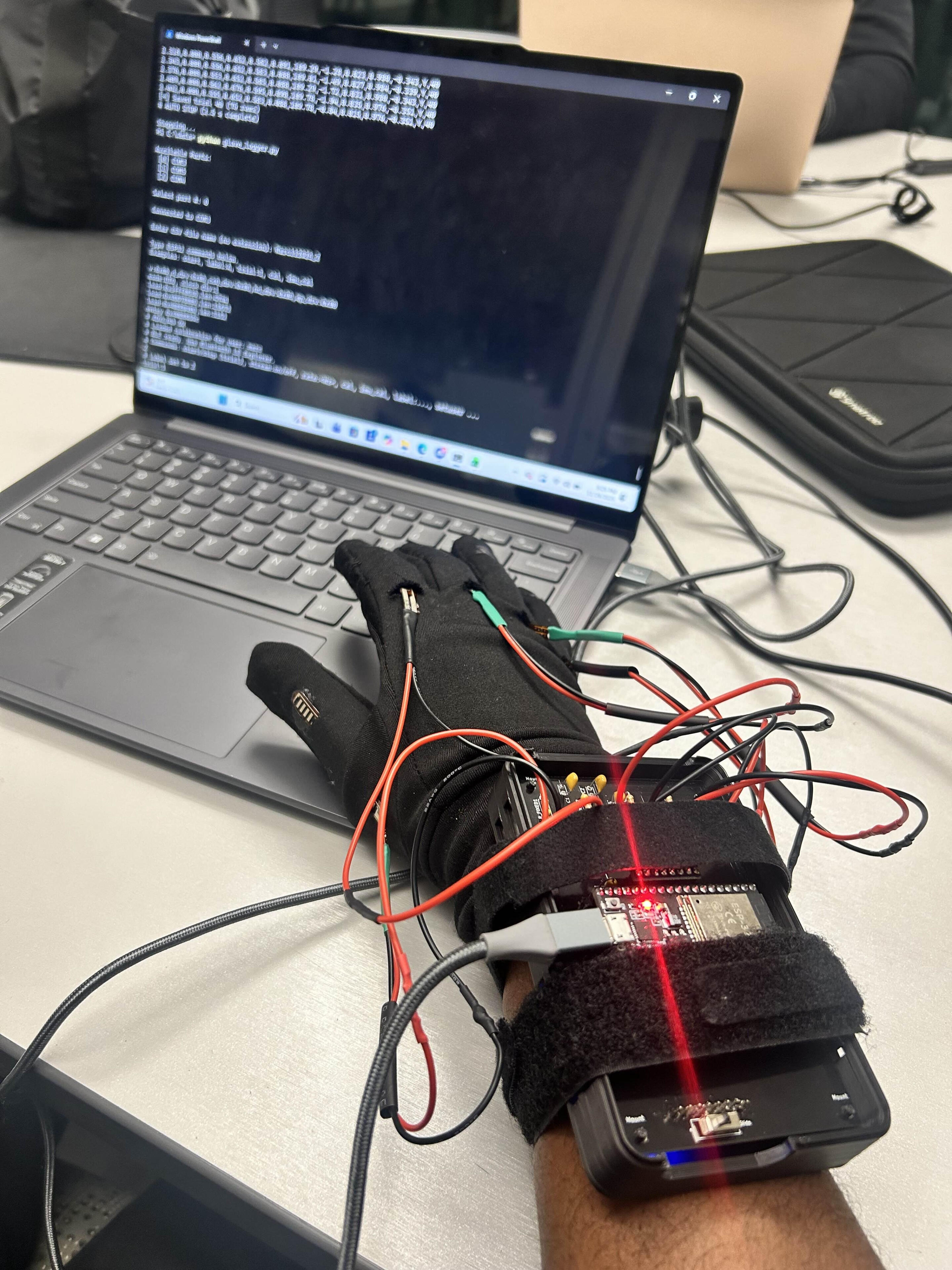
Developed a series of increasingly capable systems for automated ASL recognition, progressing from CNN-based single-image classification to Vision Mamba architectures and multi-focus image fusion for robust real-world performance. The most recent work in this line achieves high classification accuracy across the full ASL alphabet and advances the state of the art in efficient sequence modeling for vision tasks. A subsequent effort developed a real-time ASL translation system using a wearable instrumented glove and mobile application, combining deep learning gesture recognition with keypoint tracking for accessibility applications.
Publications:
Biometrics Identification
Finger Knuckle Print · Facial Expressions · Low-Complexity Computation
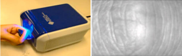
Biometric systems deployed on embedded hardware face a constraint that laboratory benchmarks often ignore: the model must run within tight compute and power budgets. We developed classification systems for personal authentication based on finger knuckle print (FKP) biometrics, progressing from quantum-computing-based models to pretrained vision transformers and the Vision Mamba architecture. The Vision Mamba approach achieves high classification accuracy at significantly lower computational complexity than transformer baselines, making it well-suited for deployment on resource-constrained biometric devices, offering a less intrusive alternative to fingerprint capture with comparable discriminative power. Related work addresses facial expression classification across varied head poses, where conventional methods degrade sharply outside frontal views.
Publications:
Marine Species Distribution — Protect Florida Whales
Spatial Analysis · Species Distribution Modeling · Ecological AI
Funds: Population, Health and Behavioral Ecology Program
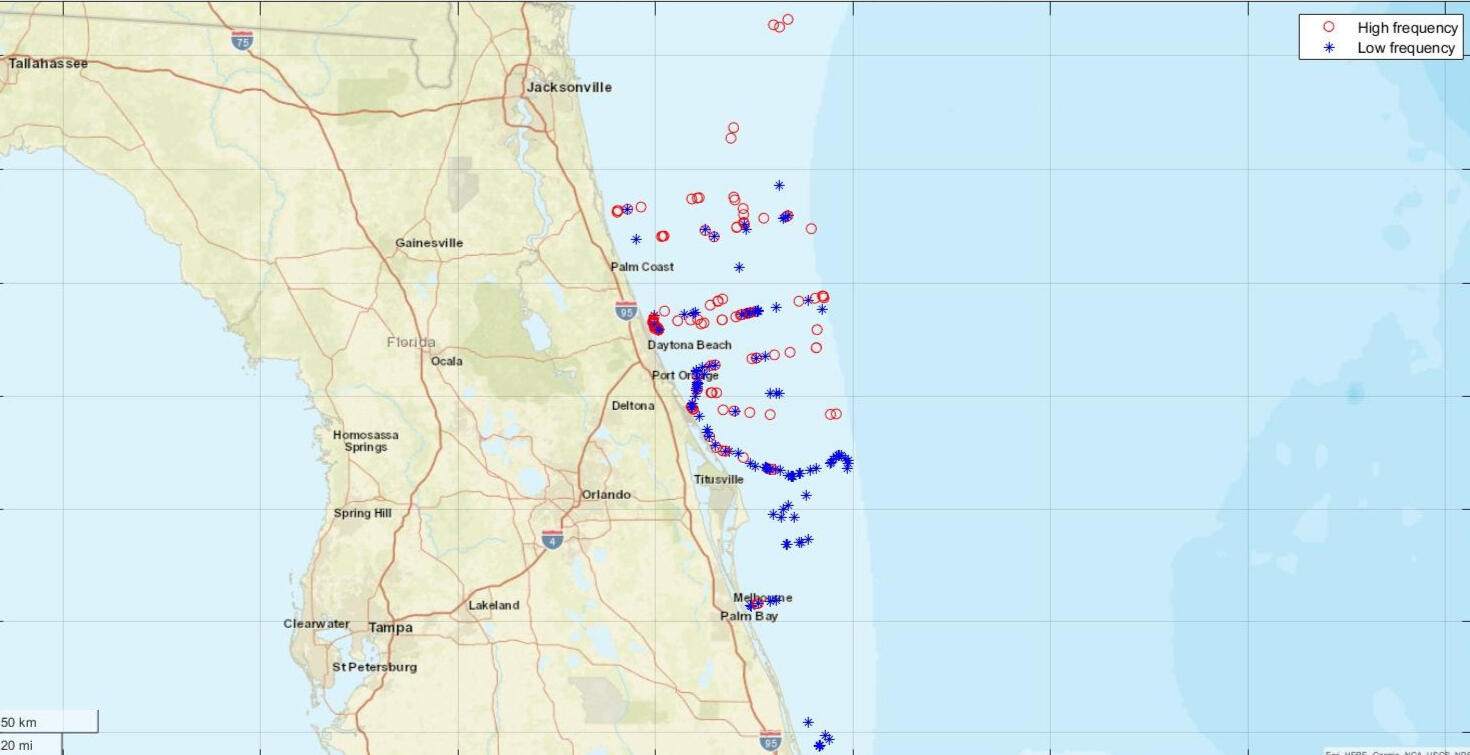
Studied marine mammal population dynamics along Florida's Atlantic coast, developing analysis pipelines for spatial distribution assessment of whale species. Work contributed to conservation planning and behavioral ecology research by providing data-driven spatial models of species presence and movement relative to environmental conditions.